


#116 Charm of Japanese Mountains
Two days without PC or TV, away from the hustle and bustle of Tokyo.

I live in the western suburbs of Tokyo and have access to the attractive mountains of Yamanashi and Nagano prefectures whenever I feel like it. Still, for the past ten years or more, I have only been able to go hiking on day trips during autumn leaves. However, I remembered carrying a tent in the mountains the other day. After a long time, I decided to go to Yatsugatake, west of Tokyo, while I could still climb mountains overnight in a tent.
Although I had expected, I discovered many things I could only have known once I went there, such as my declining physical fitness, the evolution of climbing equipment, and changes in the environment surrounding mountain climbing. Mt Fuji is by far the most well-known and popular mountain among foreign travelers, but in terms of abundant natural beauty, there are mountains in Japan that are even more attractive than Mt Fuji. In this post, I want to tell you about my first mountain trip in a long time, where I stayed in a tent, and I hope it will make you more interested in the mountains of Japan.
Primary Data on the Yatsugatake
What is the Yatsugatake?
The Yatsugatake Mountain range is in Nagano and Yamanashi prefectures, roughly in the center of Honshu. It is a unique mountain range formed by many peaks and a quasi-national park. However, there is no single mountain named "Yatsugatake". Yatsugatake" is the collective name for a series of mountains.

There are various theories as to the origin of the name, such as "eight peaks" in a row can be seen" or "eight," meaning "many," because there are many mountain peaks in a row. The mountains are expansive in a north-south direction and show various faces. The mountains are full of natural attractions, such as a thick virgin forest in the north and a magnificent foothill centering on Akadake (2,899 m above sea level), the prominent peak of Yatsugatake, in the south.

Type of mountain trip
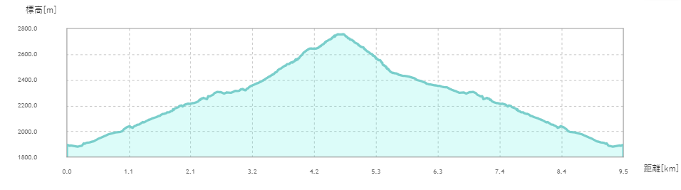
Using the Oren Hut site, two days and one night in tents. The cumulative elevation gain for ascent and descent is 1,086M. The distance from the center of Tokyo to the parking lot in Sakura-daira is about 190 km, and the driving time is a little over 3 hours, depending on highway congestion.

Yatsugatake has many faces, ranging from steep rocky ridges of nearly 3,000 meters to mossy primeval forests. The trailhead and climbing route differ greatly depending on what elements of the mountain you are looking for, but the trailhead I chose this time was Sakura-daira, the closest trailhead to the ridge line that can be reached by car. I chose a route that would allow me to get to my tent site in less than two hours on the first day, walk along the ridge the next morning, return to camp, and return to the parking lot and Tokyo the same day. It had been a long time since I had stayed in a tent on a mountaineering, and counting back again, it had been several decades. Therefore, I was concerned about climbing the steep slopes with a tent, sleeping bag, and food in my backpack, so I chose the easiest route.
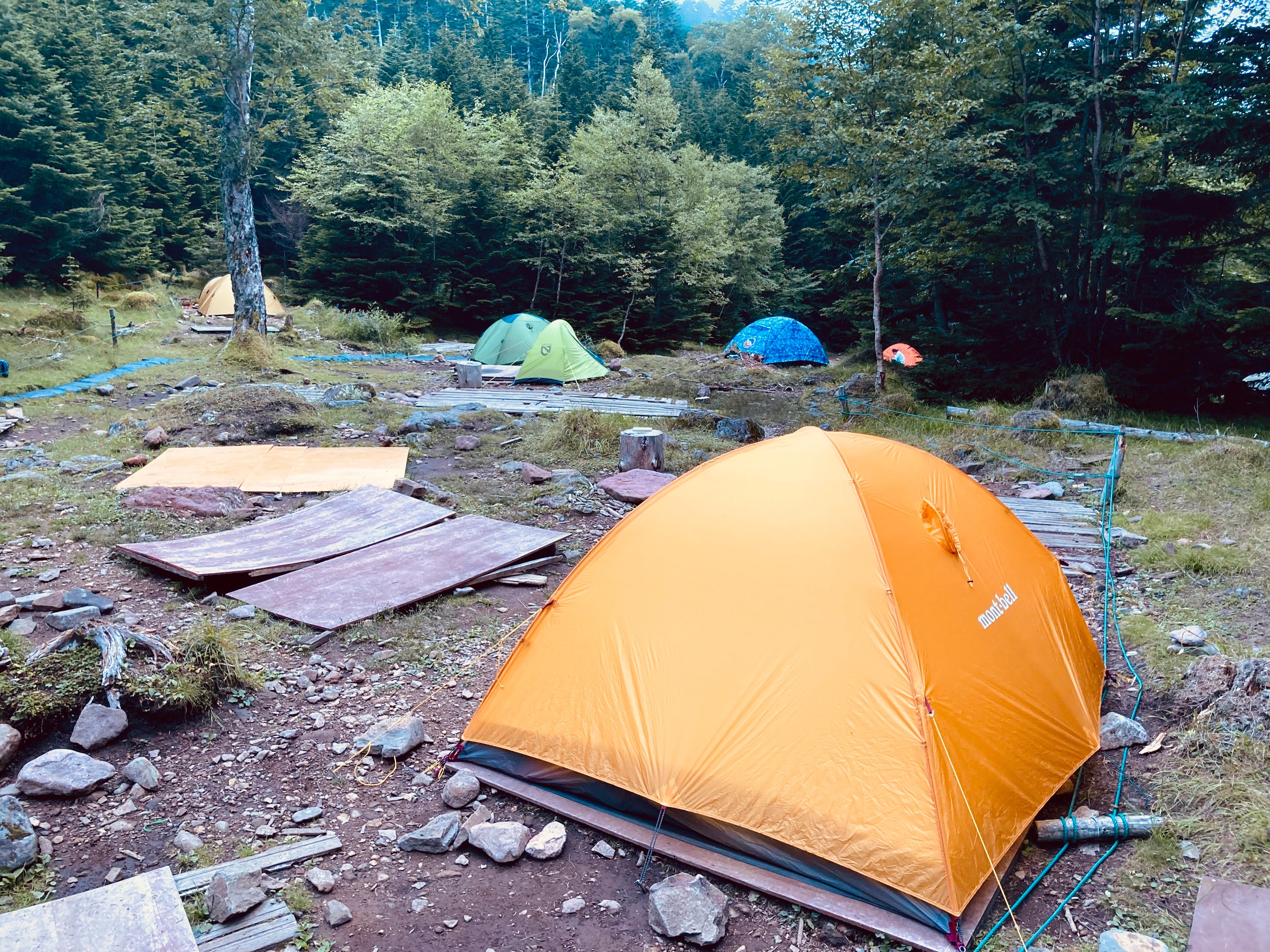
When staying in tents in the mountains of Japan, you should set up tents in campsites adjacent to mountain lodges. Pitching a tent in an arbitrary location is almost always prohibited in Japanese mountains. You can only put up your tents in designated national parks, quasi-national parks, and other areas managed by the government. Please keep in mind about this.
Access by a private car
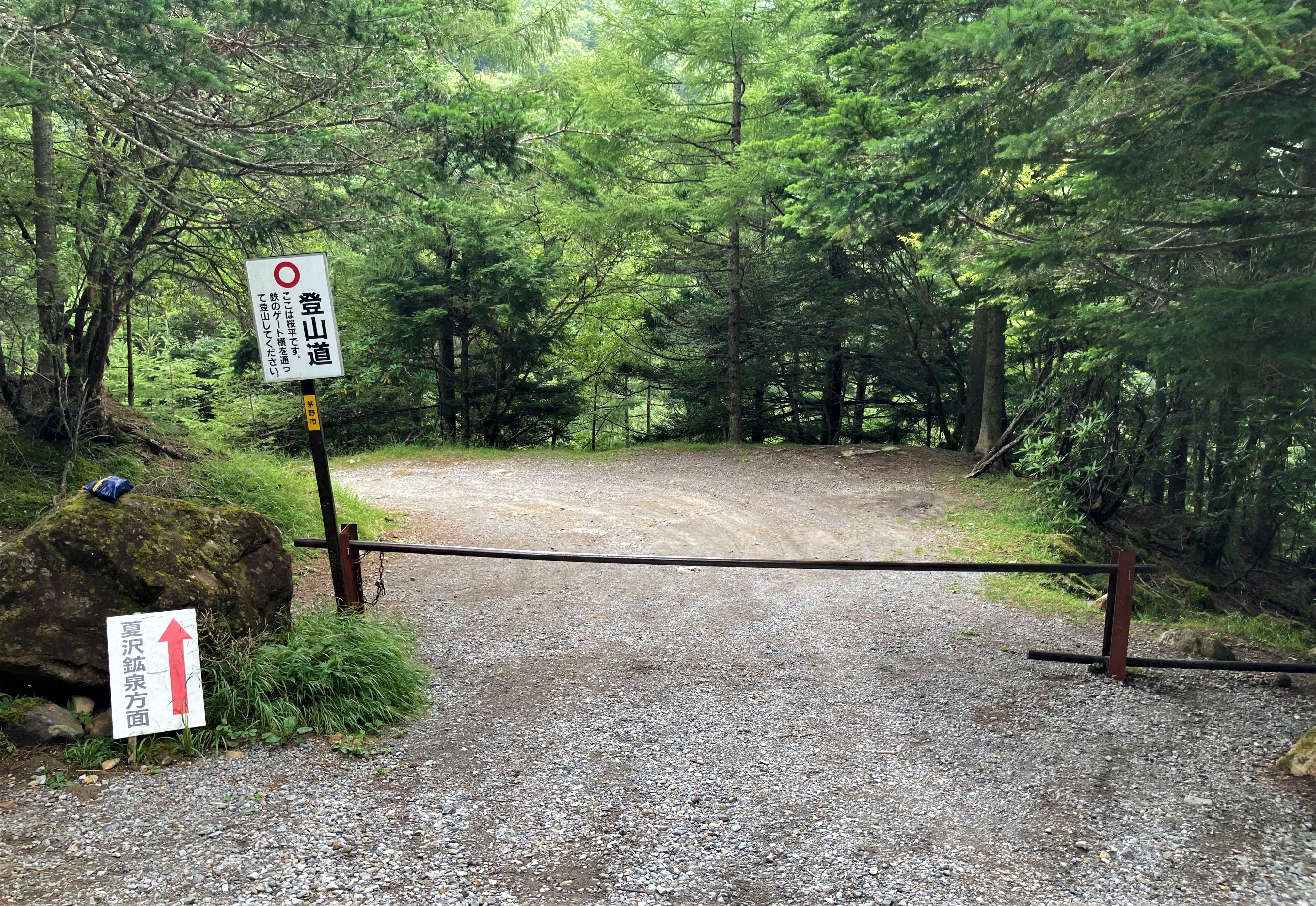
To get to the parking lot at Sakura-daira, located at the western foot of the Yatsugatake range, you can use a private car (rental car) or a cab from Chino Station on the JR Chuo Main Line. No buses are running. There are three parking lots in order of proximity to the trailhead gate, with a total capacity of about 150 car spaces. However, the furthest parking lot is 3.5 km from the gate, so it is best to park as close as possible. You will only find your parking lot on weekends and during the foliage season if you arrive before sunrise. The gravel road is narrow and goes several kilometers before the parking lot. Driving a car on the road is not impossible, but you must drive carefully at 10 km/h or less.
The route
This time, the route was straightforward: from Sakura-daira to Natsuzawa Kasen, overnight at the campsite at Oren Hut, and the following day, before folding the tents, go out to the ridge line of Mt Io, and return to the campsite in 3 hours, returning to Sakura-daira after lunch.
Sakura-daira to Natsuzawa Kosen: The track is a broad, well-maintained trail, and the gradient is steep.

Natsuzawa Kosen to Oren Hut: After climbing a broad, steep slope for about 20 minutes, I entered a wooded area and an actual mountain trail. After walking on the trail for about 30 minutes, you will reach Oren Hut. The trail is wide and easy to walk on.
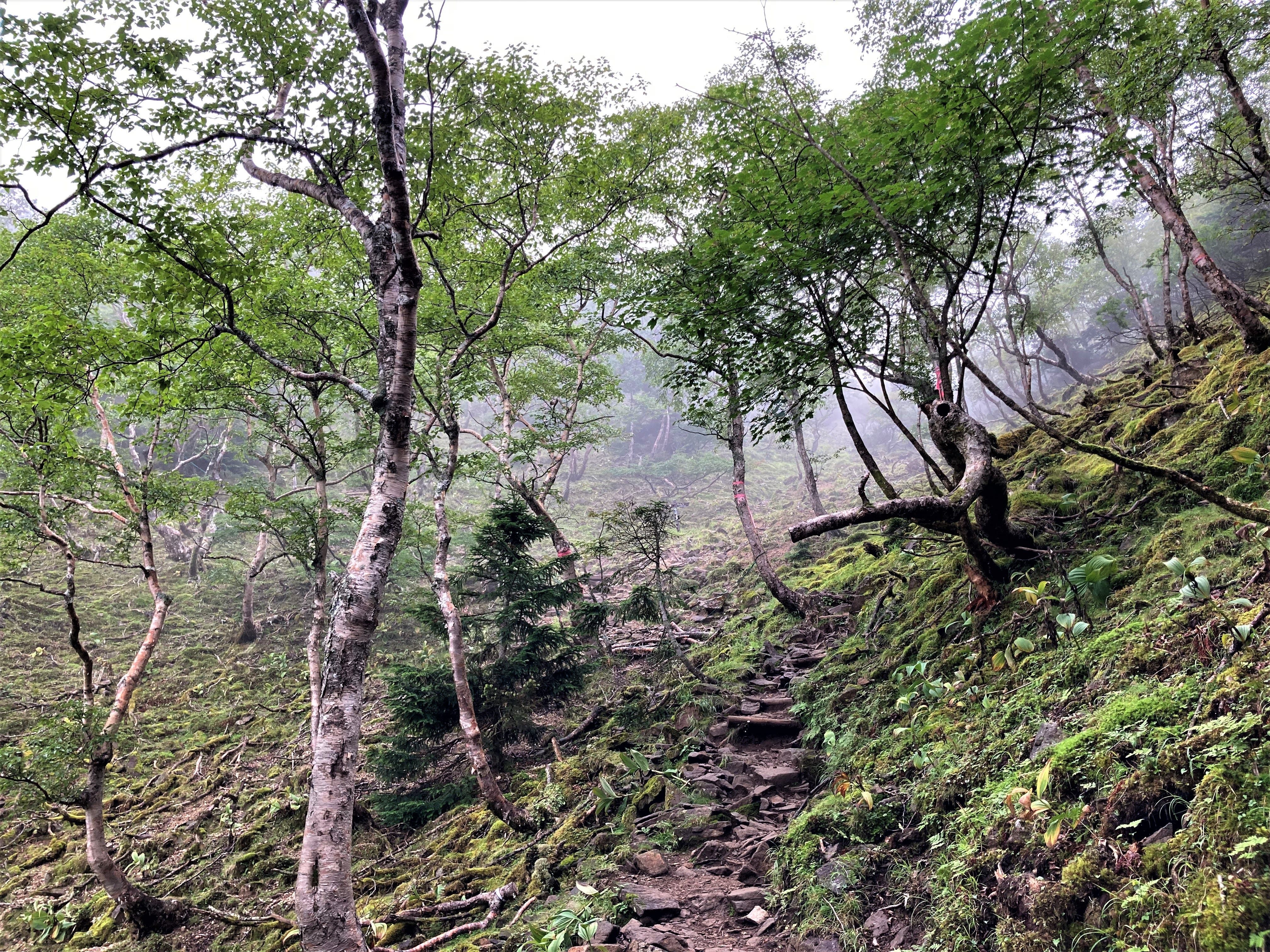
Oren Hut-the ridge line-Mt. Io-Natsuzawa Pass-Oren Hut-Sakura-daira: From Oren Hut, I tried to head to the summit of Mt. Io in the shortest possible time and return to Oren Hut via Natsuzawa Pass. From Oren Hut to the ridge, a steep trail continues through the forest until you reach the ridge, but once you get there, a gentle descent follows. If you take the reverse course, the ascent becomes less steep, but the distance of the ascent becomes longer. From O-ren Hut to Sakura-daira, I slowly descended the same way as the previous day. From the Oren Hut to the Sakura-daira parking lot took about an hour. Since it was a weekday, the Sakura-daira parking lot needed to be more sparsely populated.
If you come from Tokyo by public transportation, you will inevitably have a bottleneck from Chino Station to Sakura-daira. If you stay at Natsuzawa Kosen, there will be a shuttle bus service by car, although the hours are limited. If you take the express train arriving at Chino Station at 09:07 in the morning on weekdays, you can take the shuttle bus directly to Sakura-daira. On the way back, if you take the shuttle bus from Natsuzawa Kosen around 14:00, you will arrive at Chino Station around 15:30, relax at the station, take the limited express departing at 16:20, and arrive at Shinjuku at 18:45.

Highlights of the mountain trip
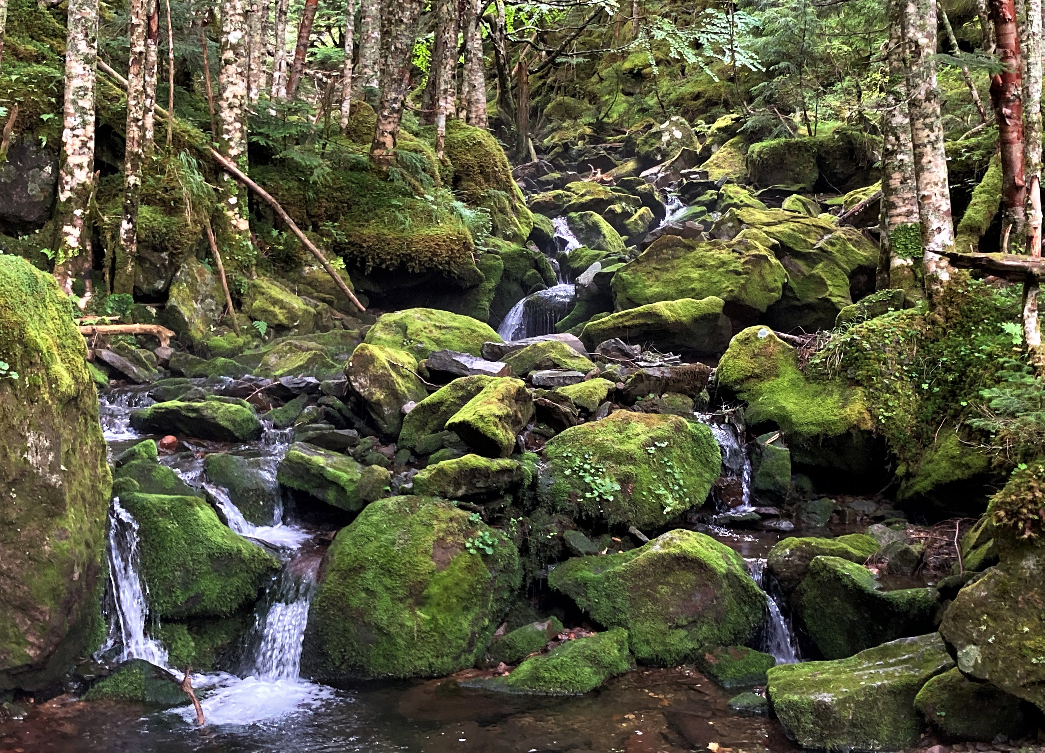
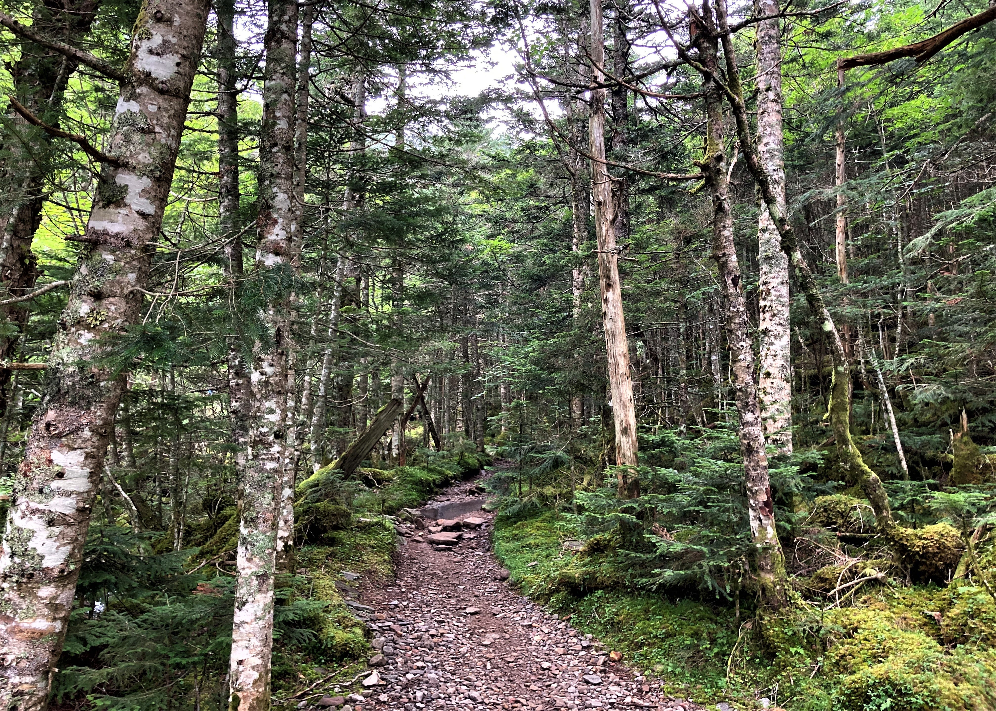
The tree line from the trailhead to the Oren Hut is spectacular. The moss and river flowing through the deep green forest collaborate.
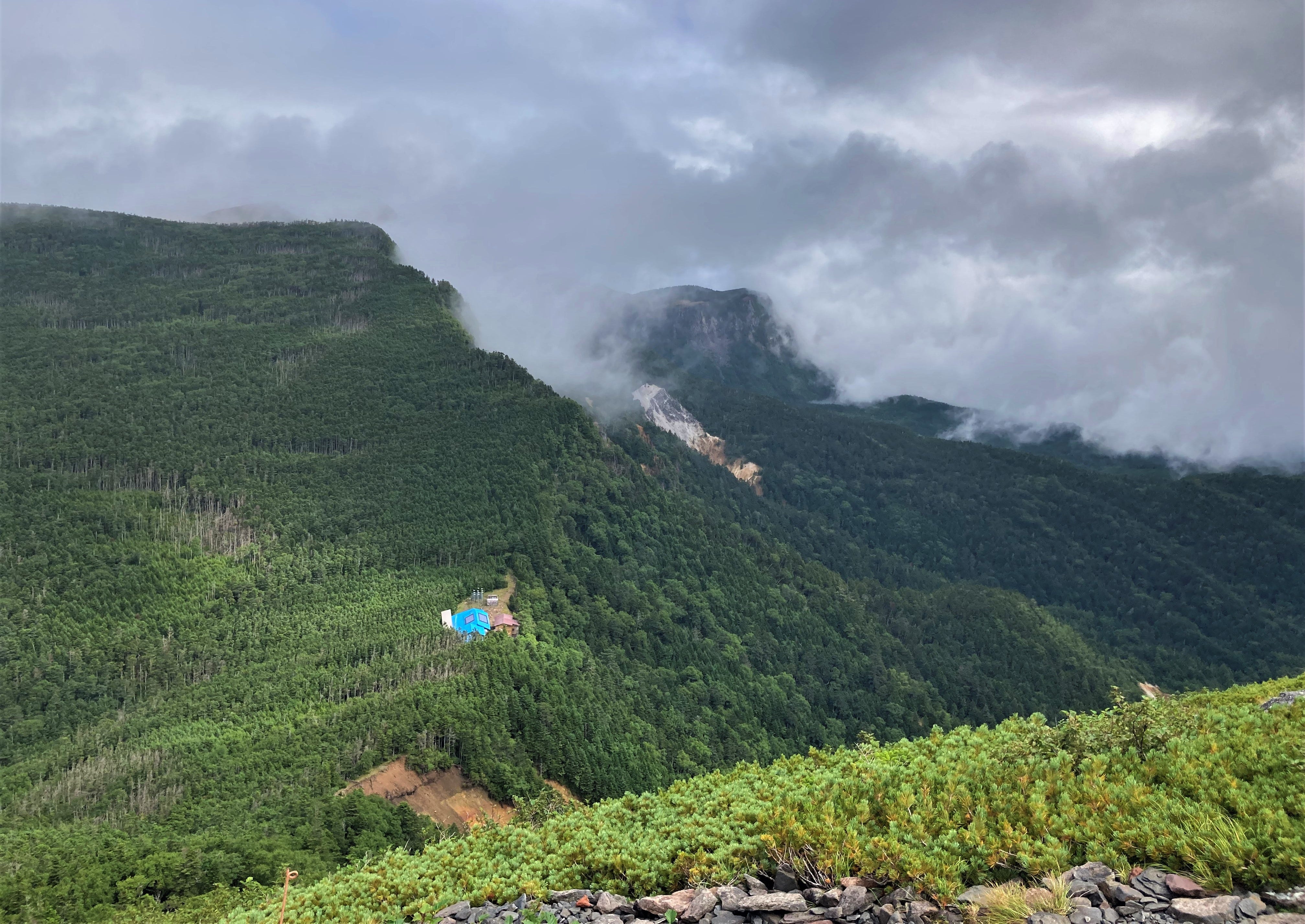
The Yatsugatake mountain range is seen from the summit of Mt. Io.
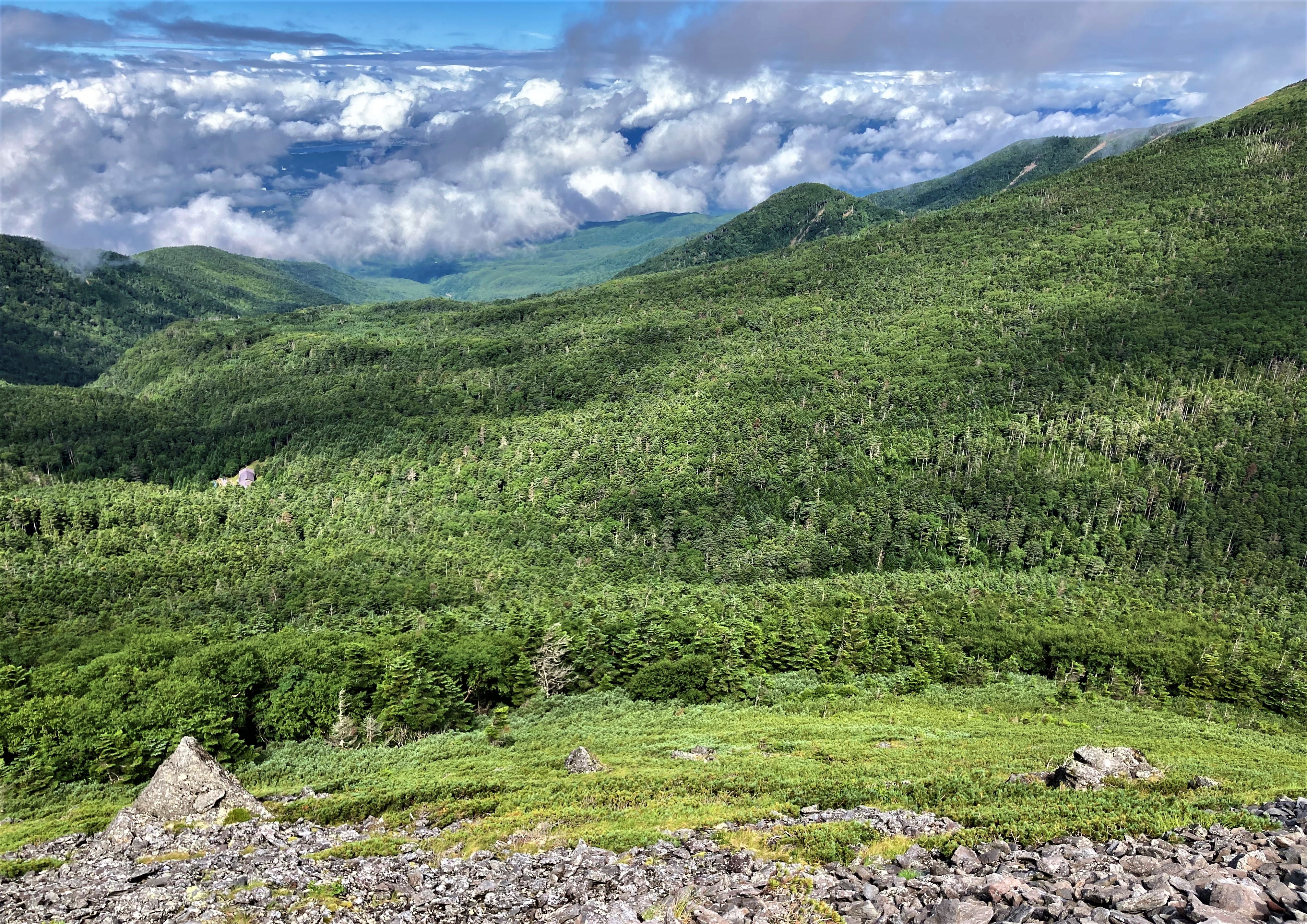
You can see the forest zone stretching to the west of Mt. Io.
Notes for foreigners going by yourself
If you do not stay at Natsuzawa Kosen, you can take a cab (about 11,000 yen) or rent a car from Chino Station. If you rent a car, it is better to arrange an SUV type. I used a low-height passenger car, which took me about an hour to travel the last few kilometers. In deeply rutted areas, you must keep driving while choosing your course.
The only huts were Oren Hut and Natsuzawa Kosen. Both are comfortable mountain huts, complete with baths. The rates are 14,000 yen per night with two meals (breakfast and dinner) at Natsuzawa Kosen and 13,000 yen at Oren Hut. Oren Hut charges 2,000 yen per person per night for a tent stay. If you do not have the proper equipment, it would be safe to stay at either hut.
Unfortunately, all the signposts on the course are in Japanese, not English. Therefore, you will need to be able to read a map accurately if you want to enter this mountain range and rely on your smartphone's translation for signposts. In addition, there are several places on the trail where it is easy to get lost, so it is always necessary to ensure you are on the correct route. If you need more clarification, please stop and check that you are on the right path by checking the red markings in the vicinity. And above all, always check where you are.
Cellular phones are almost useless in this area except for Docomo. It'd be great if you're going to be with an overseas carrier, but if you're replacing your SIM card after arriving in Japan, please be sure to use a Docomo line.
What I can offer
After writing this post, I realize that it may seem like a lot of work for an overseas traveler to make plans, such as recognizing maps and signposts in English, getting to the trailhead, etc. However, there is a lot of information that I can quickly provide, such as transportation arrangements to the trailhead and a rough hiking schedule. If you are an avid hiker and would like to visit places few foreigners have ventured before, please ask me in the comments section. I will be happy to help you. I have been to most of the mountains in the Kanto area, so I can easily visualize the area.
The Best Part of Mountaineering in Japan
There are 23 mountains in Japan with peaks over 3,000 meters, including the highest peak, Mt. Fuji, at 3,776 meters. However, the vegetation created by Japan's unique and complex topography and the delicate scenery that changes its expression from season to season should be a significant attraction for visitors from abroad.
As the number of repeat visitors to Japan grows, they will surely turn their attention to Japan's mountains. In that sense, I would like everyone to experience Japan's cultural temples, shrines, and mountain travel, which you can only experience in Japan.
If you are considering a second or third visit to Japan soon, a small mountain trip would be a good idea.
Japan has so many fantastic mountains beyond Mt. Fuji, which is way too overcrowded so it’s great that you have highlighted Yatsugatake. The photos are beautiful and as always the details you provided are really useful.
Hello Tanikawa-San. We are so grateful for the information you share with us from your amazing country.
Would you please recommend a top-10 of places to visit outside the main tourist sites (Tokyo, Kyoto, Osaka, Nagashaki, Hiroshima, Nara) that represent traditional and old Japan?
If you have already done so to an older post I would be most grateful if you point me to the right direction.
Much obliged.